Sunday, March 18, 2012

Spring Adventure Idea - Sovereign Trail Singletrack, Moab

Spring is almost here. In Utah, Spring means it's time to start dreaming up trips to Moab - warm weather, red rock, and outdoor adventures. When you think of Moab, the first thing that comes to mind is mountain biking. One of my favorite rides near Moab is the single-track Sovereign Trail.

The Sovereign Trail system offers mountain bikers a little bit of everything. Climbing gently up Salt Wash, the trail surface alternates between slickrock and packed brown dirt, mostly avoiding the frustrating sand traps that plague some of the area's other trails. The varied character of the ride keeps things interesting and challenging, but is not too difficult for those new to riding single track. Making it a popular route for both beginners and experienced riders.

Several variations along the route spread bikers out and keep the popular trail from becoming too crowded. They also offer different length rides so you can custom tailor your tour. As the single track gains elevation, views spread out of the surrounding red rock country. Arches National Park is to the south, and Canyonlands National Park to the west. The trail is easy to follow, even across the slickrock, but you'll want at least a rudimentary map to navigate the multiple trail junctions. Small drops over sandstone ledges and a section of sharp switchbacks offer notable technical challenges along the trail. But these are balanced by sections of smooth, fast single track.

If your trip includes camping, pick up a copy of my guidebook, Moon Utah Camping for information on all the Moab area campgrounds.

Thursday, March 1, 2012

Wasatch Backcountry Skiing is Under Siege

Love skiing in the Wasatch backcountry? Not for long. That's right, if the ski resorts get what they're applying for, you'll be hard pressed to find any quality terrain left outside the ski area boundaries.

Five of the seven major ski resorts operating in the Central Wasatch Mountains are attempting to gobble up the remaining mountains outside their borders - by adding chairlifts and turning the entire heart of the range into one, connected sea of lift-access terrain. Backcountry ski legend, and author of the Chuting Gallery, Andrew McLean outlines the impacts of the nine new lifts here on his blog - StraightChuter.com. According to an article in the Deseret News, if all the lift proposals were to go forward, the total acres of in-bounds terrain would more than double, adding as many as 8,270 acres to the 6,294 acres now.

If you only love skiing in-bounds, you might think this is great news, but if you've ever had a memorable day in the Wasatch backcountry, and hope to have more in the future, then now is the time to speak up. Because before long, this little range will be maxed out with chairlifts, aerial trams and gondolas to every ridge top. Grizzly Gulch, Flagstaff Mountain, Silver Fork, Cardiff Fork, USA Bowl, Wolverine Cirque, Twin Lakes Pass, White Pine - you name your favorite backcountry destination, it'll be inside a resort, tracked out by noon.

There's nothing new about the Wasatch ski resorts trying to expand. In fact, they've been slowing spreading their collective footprint since the first ski lift was installed at Alta in 1937. But at some point, we, as Salt Lake City residents, need to decide when enough is enough. How developed do we want the Wasatch to be?

Let's take a closer look at the new lift projects currently proposed.

  • The Canyons/Solitude SkiLink Connect Tram
The Canyons, owned by Talisker Corp. is partnering with Solitude Mountain Resort in a joint effort to connect the two ski areas with a gondola. The 8 passenger lift, dubbed SkiLink, would access 6,000 acres of current backcountry terrain - starting at the Solitude base area and unloading at the top of the Canyon's Daybreak lift. The nearly two mile long lift could deliver 1,000 skiers per hour to the top of the Park City Ridge Line, accessing backcountry favorites like USA Bowl, and Bear Trap Fork.

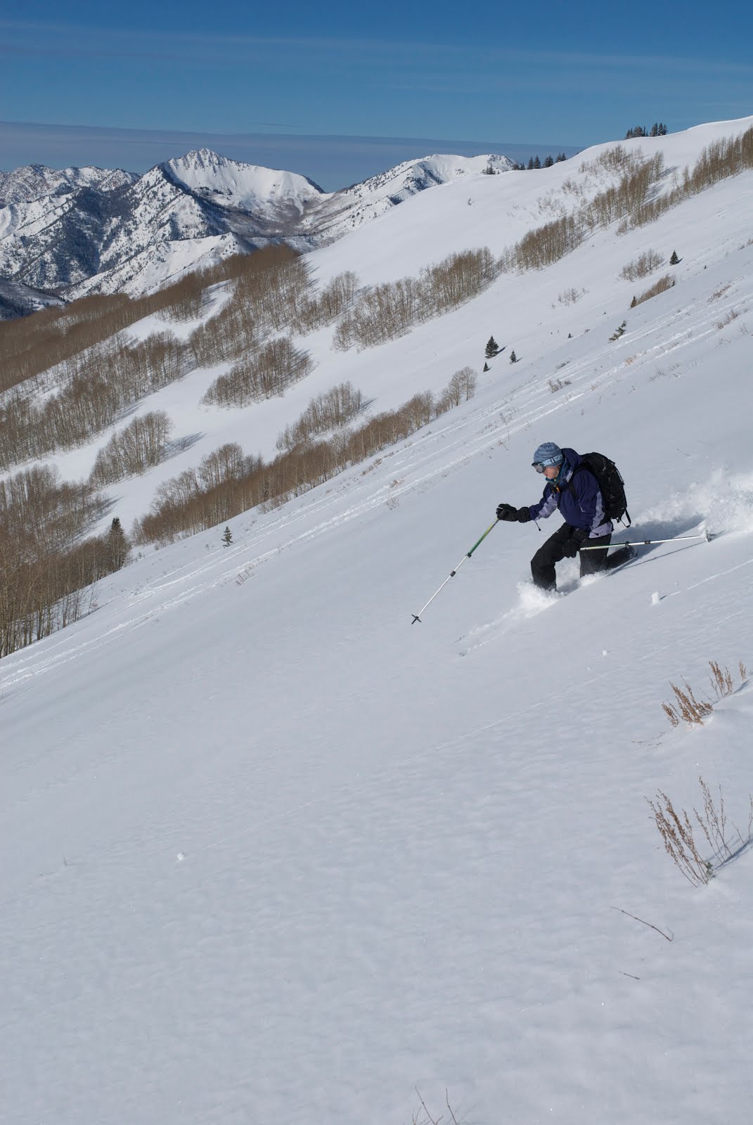
To build their gondola, this partnership has pursued purchasing a 30.3 acre parcel of public land at the top of Big Cottonwood Canyon. In an effort to acquire the land, a bill has been introduced to Congress - The Wasatch Range Recreation Access Enhancement Act, to remove the land from the federally protected watershed, and put it in private ownership. Therefore eliminating the Forest Service, who's current forest plan prohibits ski resort expansion within the Cottonwood Canyons, from the decision process. Salt Lake City Public Utilities, who provides drinking water for Salt Lake from Big Cottonwood Canyon has expressed concern over the proposal. (Backcountry skier Sonja Matson in USA Bowl, above)

  • Snowbird Tram to American Fork Twin Peaks
Snowbird has proposed a new expansion package to the Forest Service. Its centerpiece is a new tram running from Hidden Peak to the West Twin of Twin Peaks American Fork Canyon. The expansion would add 780 acres of Mary Ellen Gulch into the Snowbird Resort boundary. The Forest Service has accepted the proposal, and is considering it for approval.

From a backcountry skier's perspective, this tram is also concerning because it would provide resort skiers easy access to White Pine Canyon's upper bowls. While Mary Ellen Gulch doesn't get much use because access is limited by the location of Snowbird, White Pine is one of the most popular Little Cottonwood tours. (Backcountry skier Kelly Paasch in White Pine Canyon, above)

  • Alta Lift on Flagstaff Mountain
Alta is exploring the idea of a new lift up Flagstaff Mountain on the north side of Little Cottonwood Canyon. Their rationalization: the lift would make avalanche control work safer, by eliminating the use of artillery fire across the canyon. The new lift would in turn allow skier compaction of the slopes, helping to stabilize Upper Little Cottonwood Canyon's snowpack. Can't argue with that. But the lift would provide access to some of the most popular backcountry terrain in the world. Grizzly Gulch, Flagstaff Mountain, Twin Lakes Pass, all these popular tours would either be inside Alta's ropes or part of their easy access "side-country".

  • Solitude Mountain Resort's proposed new lift in Silver Fork Canyon

Solitude has proposed a new lift in Silver Fork Canyon. The package would include re-aligning the Honeycomb return chair for a return ride from the bottom of Silver Fork. The new lift would access a total of 298 acres of backcountry terrain, (182 Forest Service/116 private). The Silver Fork lift and Flagstaff Mountain lifts would essentially connect Alta and Solitude at the ridge. Again the Solitude "side-country" would expand under this proposal too, with easy access to neighboring Days Fork, and the very popular backcountry runs of Meadow Chutes on the west side of Silver Fork Canyon.

  • Park City Resort's Jupiter and 10420 Lift

Park City Resort is exploring building two new lifts in the Guardsman Pass area, one to the top of Jupiter, the other to Peak 10420. These lifts would expand Park City's boundaries to the north edge of Brighton Resort.

Here's a link to a KSL video about the overall effect of the proposed ski area expansions.

Wednesday, January 4, 2012

Self Portrait - Ten years in the making


I'd been wanting to make a photo like this for a long time. About 10 years, actually. Sometimes though, realizing the image in your minds eye takes a little more time and effort than you'd expect.

Paragliding has been a dream of mine since following my college roommate Matt to Sun Valley, Idaho in June of 2000. Matt was, and still is, an avid pilot, and his life that summer revolved around flying a paraglider. Photographing Matt and his friends soaring glass-off conditions before sunset in the Boulder Mountains cemented my desire to fly, even though I couldn't afford it at the time. The light was stellar, and I was happy to be taking pictures, but part of me felt a little jealous I couldn't join those guys in the air. The seeds of my desire to fly had been firmly planted on my bucket list that summer.

Ten years later I found myself living in Salt Lake City, in a valley that turns out to be an excellent place to learn to paraglide. At the south end of the Salt Lake Valley, a long ridge extends out of the Wasatch Mountains, and ramps down to the valley floor. The ridge, known as the Point of the Mountain, divides the Salt Lake and Utah valleys from one another. "The Point," offers consistent soaring conditions for paragliding eight months out of the year. With an easy access training hill less than 20 miles from my house, and a handful of well respected paragliding schools to choose from, I found myself strapping into a paragliding harness for the first time.

Learning to paraglide is only part of this picture. Taking interesting photos while dangling from a fabric wing presents more than a few challenges. First and foremost, pargliding photography requires enough skill and good judgement as a pilot to take pictures safely. When the conditions are good at the Point of the Mountain, there are enough other pilots in the air that it requires your full attention to safely avoid a mid-air collision. Busy skies also take something away from the drama of paragliding photographs much like a picture from a crowded ski resort doesn't compare to one shot in the backcountry. So even when I could find open airspace to pull out my camera at the Point, my early attempts at capturing the freedom and drama of paragliding came up somewhat short.

As my flying skills improved, moving to less crowded sites offered the space to take my hands off the controls, and put my eye to the viewfinder. Mountain sites like The B in the shot above, also provide a more dramatic mountain backdrop for great photos. The launch for The B is at the mouth of Big Cottonwood Canyon. Thermaling above launch provides views into Fergusen Canyon and the lower ridges of Twin Peaks.

The final component to this shot was stepping away from the DSLR camera and using the GoPro camera mounted on a trekking pole. GoPro cameras are everywhere in the paragliding scene, mostly mounted on pilots helmets to record video of their flight from a POV perspective. While these videos become repeatitive after you've watched a few, the fisheye lens is perfectly suited to capturing the pilot from the end of an extension pole. It shows the pilot's position in their harness, and the wild freedom of flying high in the mountains.

Friday, March 26, 2010

Little Wild Horse Canyon in Utah's San Rafael Swell

Spring is just around the corner which has many of us dreaming about warm weather adventures. Southern Utah is the place to head for early season warmth. If you're looking for a cool idea to jump-start the new season, consider Little Wild Horse Canyon in the San Rafael Swell. The eight mile loop hike (when combined with the neighboring Bell Canyon) offers explorers red rock, slot canyon beauty with easy access and relatively minimal effort. Located near Goblin Valley State Park, Little Wild Horse Canyon is one of the closest slot canyons to Salt Lake City.

Expect to encounter other-worldly scenery in Little Wild Horse Canyon. Narrow passages, wildly sculpted sandstone walls, quiet isolation, and lovely reflected sunlight can all be found in the bowels of the canyon. Little Wild Horse is also an immensely popular hike, so don't be surprised to encounter other hikers and hear their voices echoing down the stone corridors.


The normal hazards associated with slot canyon exploration apply in Little Wild Horse. Flash floods can and do occur during spring storms. If rain is in the forecast, avoid slot canyons altogether. Pools of cold, murky water may be found in the upper reaches of Little Wild Horse Canyon after storms. This past weekend (March 5th, 2010) there were a series of knee deep, icy pools we had to navigate. Having a pair of sandals and a towel is a good idea if it's rained before you go.

Plan on spending four to six hours to explore Little Wild Horse Canyon. A map of the canyon is available at the trailhead.

Getting there:

Little Wild Horse Canyon is located near the entrance to Goblin Valley State Park in the San Rafael Swell region of Central-Southern Utah. From Salt Lake City head south on I-15. Take Exit 258 onto US Highway 6 and follow Hwy 6 southeast to the junction with I-70. Take I-70 west via the ramp to Salina. Follow I-70 west for 0.3 miles and exit following signs to Hanksville on State Route 24. Continue west on UT-24 for 24.2 miles. Turn right onto Temple Mountain Road following signs for Goblin Valley State Park. Follow Temple Mountain Road for 5.2 miles and turn left at Goblin Valley Road. Drive 6.0 miles on the Goblin Valley Road and turn right at Wild Horse Road. Follow the dirt road 10 miles to the trailhead on the right side of the road. The final ten miles is unpaved, but well maintained and was easily navigated with a passenger car.


View Larger Map


Thursday, January 28, 2010

Bird Photography at Farmington Bay Waterfowl Management Area

Bald eagles, American Kestrels, Northern Harriers, Great Blue Herons, and Canadian Geese, are a few of the feathered photo ops you'll find at the Farmington Bay Waterfowl Management Area on the south shore of the Great Salt Lake in Bountiful.

Bird enthusiasts and photographers can be found slowly cruising the raised, pot-holed road through the Farmington Bay Waterfowl Management Area this time of year. Massive zoom lenses attached to digital cameras hang out of car windows or poke through sun roofs, their owners waiting patiently to catch any exciting bird behavior that might unfold.

Winter is an exciting time of year for bird photographers in Utah because large, photogenic birds like eagles, hawks, and herons are all within shooting distance of the road at Farmington Bay. Using their cars as mobile wildlife blinds, photographers creep slowly towards their prize, and call on long-reaching lenses to capture intimate portraits of their avian targets.

If you'd like to try your hand at Farmington Bay, here's a few suggestions on how to go about it.

Farmington Bay Waterfowl Management Area is a great place to get relatively close to birds because a road system is built out into the wetland on dikes. The freshwater bay attracts a variety of birds with an assortment of reliable food sources. On the one hand, the shallow freshwater lake provides carp for Bald eagles and small fish for blue herons, while the tall-grass wetland offers up rodents and other prey for hawks and other seasonal raptors. The wetland also attracts waterfowl like ducks, geese, and gulls, who in tern act as prey for raptors and other predators.

Driving slowly along the road in your car is the best and easiest way to approach birds for photography. Birds generally don't feel threatened by people in their car the same way they do when a human is walking near them. This makes it easier to "sneak up" on birds using your vehicle as a blind, than approaching on foot. With the right equipment a vehicle can also function as a portable tri-pod or camera support - which is important when using a long telephoto lens. Window camera mounts offer excellent stability for small to mid-size lenses, but won't provide enough support for really big glass. In which case, you'll want to use a sturdy tri-pod or mono-pod within your vehicle. Turn off your vehicle to prevent engine vibration from making your photos soft.

When it comes to lenses for bird photography, the general rule is: the longer the better! Any lens less than 300mm in length won't get you as close to the birds as you'd like. Lenses as long as 600mm are available, but you'll need a second mortgage to pay for them. So, use the longest lens you can get your hands on, and bring lots of patience to compensate for any lack of range in your equipment. Remember, even with the best equipment in the world, you'll still need tons of patience to make great bird photos.

When you do find yourself close to a prize subject, get set up and wait for interesting behavior. There's a thousand photos of bald eagles sitting quietly on a perch, but it's the charismatic behavior that sets the best photos apart. Look for situations that could become interesting. In the image above, I waited patiently while this immature eagle sat idle on this post. After about 20 minutes, hunters drove down a nearby boat ramp to launch their watercraft. The eagle didn't like them getting close, and the good action came when it was startled! If I hadn't been ready and waiting, I would have never got the shot.


View Larger Map

Friday, December 11, 2009

Switchback Article in the Outdoor Utah Adventure Journal

The Winter issue of the Outdoor Utah Adventure Journal is out. Check out my argument in the Switchback column (pages 23-24) where I debate whether Utah's powder is precious or plentiful with Couloir Magazine founder Craig Dostie. After you've read our arguments, vote on the reader survey (found here). Notice the photo used to illustrate my point is by Lee Cohen, one of the best ski photogs in the business!

Pick up the Outdoor Utah Adventure Journal at local outdoor shops like Black Diamond, REI, IME, Christy Sports and Canyon Bicycles. Or read the story online.

Wednesday, November 11, 2009

Photographing Utah's Iconic Landscapes - Subway Slot Canyon, Zion National Park

This is the third article in a series of articles exploring how-to photograph the iconic images of Utah's awe-inspiring Colorado Plateau.

Today's subject, the Subway, is a circular, tunnel-like slot canyon cut by North Creek in Zion National Park. Shutterbugs are drawn to this particular slot for it's uniquely curved walls and clear, cascading waterfalls. North Creek, which runs clean and cold when it's not flash-flooding, pours over a series of sandstone steps as it exits the Subway in a quiet chamber of exquisite beauty.

Fallen leaves lend color and intrigue to Subway photos, adding to the already rich palette found in the canyon. Autumn is a good time of year to hike into the Subway because temperatures in Zion National Park are very pleasant. During summer, the long day-hike can be oppressively hot, especially when climbing back out of the creek bed to the trailhead.

The Subway is a slot canyon that can traversed from the top-down, including technical rappels, swimming through cold, deep water pools and squeezing through narrow constrictions; or hiked from the bottom-up, on a meandering trail following North Creek up an increasingly narrowing canyon.

Serious photographers will prefer the bottom-up option. The nine mile round-trip hike (also known as the Left Fork of North Creek) presents plenty of challenge even without carrying a tri-pod and heavy camera equipment.

The trail descends quickly from the trailhead into the North Fork drainage where it dips in and out of the creek bed and crosses the stream countless times. As the trail approaches the Subway slot, the photo-ops get more and more appealing, with tall red and black streaked walls closing in around the picturesque setting. Because the Subway is almost subterranean, photographers will want a tri-pod for sharp exposures. The slow moving water pouring down through the canyon creates a wonderful subject for photos as it cascades over a variety of wild rock formations. Drop pools, narrow rock grooves, and step-like ledges all play with the trickling water to your photographic eye's delight.

Try using long exposures/shutter speeds (between 1/10 of a second and 1 full second in length) and let the flowing water go silky smooth. With the limited light in the canyon it won't be a problem getting these long shutter speeds with full depth of field. Close your aperture all the way down - think f-stops in the f/22 range. A wide-angle lens is necessary to take in the entire height of the slot canyon and works great for waterfall photos. There are lots of opportunities for macro-lens photos on this hike, from frogs living in North Creek, to wonderful patterns and textures in the sandstone.

Note: Because of the popularity of the Subway, permits are required for the hike. The park service limits the number of users to 50 per day to reduce their impact on the canyon and to maintain the quality of the experience. Permits are available at Visitor Center/Ranger Station in Zion Canyon. If you plan on camping near the trailhead, procure your permit beforehand, the ranger station is in a completely different part of the park!

Getting to the Subway:

The Subway / Left Fork hike is located in the Kolob Terraces secion of Zion National Park. Turn left off State Route 9 on Kolob Terrace Road and drive 8.1 miles to the Left Fork trailhead on the right side of the road.

For more information about hiking the Subway contact the National Park Service 435/772-0170. Permits are available at the Visitor's Center/Ranger Station in Zion Canyon.

Thursday, October 29, 2009

How to photograph Utah's iconic landscapes - North Window Arch

This is the second in a series of How-to articles about photographing the most iconic landscapes in southern Utah. Earlier we looked at how to shoot Mesa Arch in Canyonlands National Park, and now we'll examine the North Window Arch in Arches National Park, a short drive away. Both are best shot in the morning, right at sunrise, so they make a perfect pair to photograph over the weekend, one on each morning.

While the North Window probably isn't the most popular arch to photograph in Arches National Park, (Delicate Arch takes that honor) it's one of the best. The North Window perfectly frames a view of Turret Arch and the expansive red rock landscape westward towards Canyonlands National Park.

The east side of the arch catches morning sun, with the richest colors ocuring right at sunrise. Turret Arch, seen through the window, is touched by light right before the North Window, and the distant canyons a moment before that. Like Mesa Arch, being set up and ready before the sun rises is the key to catching the best light. The North Window is a short, half mile walk from the car, making it an easy access, early morning photo. Here's a link to the exact time of sunrise.

You'll want a tri-pod for tack-sharp images in the low light. A wide angle lens is necessary to frame the window and take in the whole scene. Also consider adding a polarizing filter to your lens, it will make the skies in your photo a deeper blue and add to richness in the color of the rock. Here's the settings from my camera for the photo above: ISO 400, shutter speed: 1/180 of a second, f-stop f6.3.

There's a small elevated ledge east of the North Window where it's easy to line up Turret Arch through the "window frame." On weekend mornings don't be suprised to find other photographers there with you. After all, this is one of the iconic images of Utah.

Getting there: From Moab, drive north on Hwy. 191 for five miles. Turn right into Arches National Park and continue 9.2 miles to the turn-off for the Windows Section. Turn right just past Balanced Rock and continue to the end of the road and the trailhead for The Windows and Turret Arch. Hike less than half a mile to the North Window, walk through the window to east side and scramble up to a small ledge to shoot through the North Window frame.


View Larger Map

Monday, October 26, 2009

How to photograph Utah's iconic landscapes - Mesa Arch

Utah is home to some of the most unique geography in the world. Inside its borders are five different national parks, all of which display parts of the mind-boggling beauty of the red-rock desert in the southern part of the state, known as the Colorado Plateau. The sandstone of the Colorado Plateau has been wildly sculpted by millions of years of rain, wind and geologic upheaval into a collection of domes, canyons, arches, bridges, hoodoos, and other geologic formations only found here, in our little corner of the planet.

The rock forms are so fascinating and strangely beautiful that visitors naturally want to photograph them. People travel from all over the world to experience Utah's national parks like Arches and Canyonlands and take photos of the rock "sculptures". We're lucky enough to have them right here in our backyard. A few of these rock features attract the most attention from visitors and photographers, and have been elevated to an iconic status by appearing repeatedly in print. From billboards to glossy coffee-table books, to park brochures, you'll see these spots representing the beauty of the Colorado Plateau. If you've ever wanted your personal photos to measure up to the published images that drew you to the southern Utah in the first place, read on.

Here's a look at how to photograph one red rock country's most published icons, Mesa Arch.

Mesa Arch sits like a window frame above an awe-inspiring drop in the Island in the Sky District of Canyonlands National Park. The "window" looks out over thousands of feet of air, an intricately carved canyon floor, sandstone towers, and a landscape that can't be acurately conveyed with words alone. Trying to fit all this onto a digital sensor the size of a postage stamp can be quite the challenge.

Timing is everything at Mesa Arch. Mesa Arch faces east and therefore is best photographed at sunrise, right as the sun's rays first illuminate the orange-red rock on the underside of the arch. The sandstone towers down in the canyon will be dramatically backlit at sunrise, making for a compelling middle-ground in the image. The best light lasts only about 15 minutes before the sun climbs higher into the sky and the dramatic colors start to fade. Be there and be ready. Arriving 15-30 minutes before sunrise will allow plenty of time to find the best angle to shoot from and get set up for the short window of opportunity. This means an early wake-up call, but it's worth it. Here's a link to the exact time of sunrise.

Bring a tri-pod and wide-angle lens to help capture the scene. A tri-pod is important because it will steady the camera in the early morning light. You'll want to shoot for the maximum possible depth-of-field to ensure sharpness throughout the image. An f-stop of f/22 or higher is ideal. Tri-pods also help with composition because they force you as a photographer to think about where to position the camera, what to include in your shot, and what to leave out. A wide-angle lens is taylor-made for capturing Mesa Arch. With a wide-angle lens, between 12-35mm in length, you'll be able to capture the full arch, plus the vista below.

Getting there: Mesa Arch is located eight miles south of the park entrance in the Island in the Sky District of Canyonlands National Park. From Moab, drive north on US Highway 191 for nine miles and turn left on State Route 313, following signs to Canyonlands National Park. Continue on State Route 313 for 22 miles to the north entrance of the park. From the park entrance continue another eight miles to the turnoff for Mesa Arch on the right side of the road. Turn right and drive a short distance to the parking area - Mesa Arch Trailhead. Hike the half-mile loop to Mesa Arch. Allow 10-15 minutes to hike into the Arch. Don't be late for sunrise!


View Larger Map

Wednesday, October 21, 2009

Capturing the Orionids Metor Shower with your camera

The annual Orionids Meteor Shower is near its peak and can be seen in the night sky around the world. The week long meteor shower is caused by the earth passing through a trail of tiny debris left by Hailley's Comet when it passes by earth every 76 years. The earth passes through this debris trail each October, causing a meteor shower as the particles flare up in the earth's atmosphere.

Watching meteor showers can be fun, but capturing a fleeting astrological event with your camera can be even more exciting. With clear to partly cloudy skies forecast for the next several days, this a great opportunity to capture this rare event on film. Here are some quick tips on shooting the night sky (and meteor showers).

Taking photos of the night sky requires some basic photographic equipment. First off, you'll need a tri-pod or camera mount (a car window mount works great for chilly nights) that can hold your camera completely still for long periods of time. You'll also want a camera that allows you take long exposures - anywhere from five seconds to five hours. Any SLR camera or digital SLR camera should qualify, as well as many mid-level to high end point and shoot camera.

Take your photo equipment to a dark area away from major light pollution. Think country roads, far from the city. Mount the camera on the tri-pod and observe the sky. The Orionids Meteor Shower should be visible in the direction of the constilation Orion, appearing in the southern sky. Because you can't predict exactly when and where the shooting stars will occur, open your camera's shutter for long exposures and see what happens. Do this using the "Manual" (M) exposure feature on the camera and adjusting the shutter speeds. Use an f-stop of f/4. Try bracketing your exposures for varying lengths of time. Start with 5 seconds, 10 seconds, 15 seconds, 30 seconds, 1 min and so on. For exposures longer than 30 seconds use the Bulb (B) setting and hold down the shutter manually or with a cable release cord. Because there is very little light in the sky aside from the stars, all these different exposures will produce acceptable photos. Pick the best looking exposure and continue to shoot at the best shutter speed. While the camera is recording the shower, watch closely where the most meteors are falling. Adjust, experiment and have fun!

For a more in-depth description of star photography read my article Shooting the Stars on my website www.mmatsonphoto.com.

Thursday, October 8, 2009

Hunting Idaho's delisted wolves

Hunting Idaho’s delisted wolves - its legal, but not everyone is happy about it

Gray wolves: Is there a more controversial species in North America?

Wolves have always seemed to generate an emotional response in people. From the classic Russian children’s book (1936) and musical piece by Sergei Prokofiev, Peter and the Wolf, to the Three Little Pigs fairy tale (1840’s), wolves have been a feared part of the natural world. These stories paint a portrait of wolves as clever, cunning, scary, and even evil. In both stories they are clearly a species to be feared. Our modern culture’s attitude towards wolves, reflected in these oft repeated stories, has led to the dramatic decline of wolves in North America, particularly in the Lower 48 States. Through hunting, trapping, and poisoning wolves were all but exterminated from everywhere in Lower 48 States outside a few isolated pockets near the northern borders of Minnesota and Montana. In 1974, gray wolves were listed as Endangered under the Endangered Species Act.


With wolves absent from the Rocky Mountain ecosystem for many years, wildlife managers began to point out that wolves actually played a positive (and irreplaceable) role in these natural systems. There was an overpopulation of deer and elk, and many of the animals were unhealthy, malnourished, or sick. There were no natural predators culling the herds. And hunters, who had effectively replaced the wolves at the top of the food chain, usually killed the strongest animals sporting the biggest trophy racks, rather than the weak and sick.

In 1987, the US Fish and Wildlife Service implemented a recovery plan for wolves in the Northern Rocky Mountains, starting by reintroducing the wolves in Yellowstone National Park in Wyoming in 1995. The plan also included the reintroduction of wolves in other Rocky Mountain States like Idaho and Montana. The program has been hotly contested by ranchers, who understandably fear that wolves will kill livestock. Environmental groups on the other hand, have praised the program as a much needed step towards a better balanced natural system in what they consider to be one of country’s strongholds for biological health, the Northern Rocky Mountains.

The reintroduction program has been largely successful from a biological standpoint, and there are now about 1,500 wolves in Idaho, Montana and Wyoming, according to Idaho Fish and Game. The wolves have been closely watched, with 84 different wolves in 50 different packs outfitted with radio collars.

On May 4th, 2009 wolves were removed from the Endangered Species List and individual states took over management of the wolves. In Idaho, wolves are being managed under the Idaho Wolf Population Management Act as big game, similar to black bears and mountain lions. Hunting of wolves is being allowed in Idaho this fall with many hunting zones opening September 15, and the rest on October 1st. All zones will be open until December 1st or until the zone’s quota is met. The state quota for the season is 220 wolves. The new law also allow any owners of livestock to "dispose" of wolves that are molesting or attacking livestock without a permit.

While it may sound as though recovery is complete and all is in order, there is a heated debate about whether the wolves are being managed responsibly. 29 wolves have been killed in Idaho this year, according to this story in the Idaho Mountain Express out of Ketchum (Sun Valley). For those people who have spent time in Ketchum or Stanley, the wolf was killed in the Eagle Creek Drainage north of Ketchum. Ketchum may be the most “wolf-friendly” town in Idaho. The Phantom Hill pack is well known in town because the animals don’t seem afraid of people and were often spotted near town last winter.

The wildlife advocacy group Defenders of Wildlife, along with 12 other conservation groups filed a lawsuit asking the courts to reverse the removal of the Northern Rockies gray wolves from the Endangered Species list. Here's their take on the situation according to Suzanne Stone, the Northern Rockies representative for the Defenders of Wildlife:

"After working more than 20 years to restore wolves here, it’s a thrill to see the wolf population finally on the threshold of recovery with more than 1600 wolves in the region. However, we cannot ignore that this delisting plan fails to protect their future and would allow states like Idaho, which has demanded that all wolves be removed ‘by any means necessary,’ to decimate the population to less than a few hundred wolves. We need a delisting plan that allows the wolf population to thrive while addressing the needs and concerns of our regional residents."

The debate continues to heat up, especially now that wolves are being actively hunted. While our society may no longer be asking "who's afriad of the big bad wolf?" There certainly is plenty of discussion about whether or not we want him around. What do you think? Tell us in the comments thread.

Friday, October 2, 2009

Fall Outdoor Photography Tips


Fall Outdoor Photography Tips

Fall is perhaps the best season for outdoor photography. The leaves are changing colors, the temperatures are ideal, and snow has started to adorn the mountains, creating dramatic backgrounds and colorful palettes for landscape photographs.

But trying to capture the colors of autumn with your camera can be frustrating. All too often you return home, pull up your shots on the computer, and feel disappointed. Somehow, those colors seemed more vibrant when you were shooting them than they look on your monitor. What happened?

If you've had an experience like this, here are some ideas to help make your fall photographs look more like what you see in your mind’s eye.

Look for close-ups. Often when we see a beautiful scene, we want to capture the whole landscape. We point our camera towards a distant vista and shoot away. And that's exactly how the photo feels, distant and boring. During fall, try a different tactic. Fall colors tend to be clumped together in specific tree species. Usually, it’s these small patches of trees that draw our attention, but relative to the entire landscape, they only make up a fraction of the scene. Try focusing on the highlights of color. Pick out the brightest leaves and focus your attention (and lens) where that color dominates. Don’t worry about the big picture, really concentrate on the color and detail. Think small and keep the composition simple.

Fill the frame with color. If you have a macro lens for your SLR, or a macro setting on a point and shoot, use it. Crop out all other distracting elements except the beautiful color. Look for patterns, abstract shapes, and variations in color that you’ll only notice in the details. Try using a shallow depth-of-field by using an f-stop with a low number (2.8, 3.5, of 4) and really focusing on the subject of your image. Let everything that’s not important become blurred.

Find leaves with light shining through them. Look for the rich warm colors created by backlit leaves. When the sunlight shines through leaves the colors seem to glow. Try shooting out from underneath or behind trees. Use the colorful trees to frame the entire landscape.

Use fall color as a background element. Find a different subject, and let the fall colors add to a soft background. Maybe it’s your friends, your dog or a mountain reflecting in a lake, but let the fall colors add a subtle element to you image rather than take center stage. Take the pressure off the colors and let it feel natural.

Use motion and blur to paint with color. By panning your camera on a moving subject with slow shutter speeds, you can stretch a colorful background into something more. Find a place with colorful trees and photograph a moving subject in the foreground. Mountain bikers, trail runners, playing kids, flying birds, there are endless possibilities. Try using a little fill flash (in rear-sync) to make your foreground image sharp. And take lots of shots – that’s the beauty of digital!

Try shooting when it’s cloudy. Cloudy days act as natural light diffusers. The clouds are effectively a huge soft box for the sun. They reduce contrast and eliminate pesky shadows. It’s like having a photography studio outside. Fall colors seem more vibrant on overcast days, so take advantage of the gloom! Remember to change the white-balance setting on your camera to “cloudy”, it’ll give those images a warmer, more appealing feel.

Finally, get out! Just because there’s a little snow in the mountains doesn’t mean you should stay indoors. Get out and shoot, that’s the only way to take great pictures!

Monday, September 28, 2009

Powderwhore's Flakes world premiere in Salt Lake City

Powderwhore, the backcountry, telemark ski focused film makers from Salt Lake City, are showing their latest effort, Flakes at Brewvies this week for three consecutive nights. The film will be shown Wednesday, Sept, 30, Thursday, October 1, and Friday October 2 at both 7pm and 9pm each night. (Dates for the rest of the tour) There will be a raffle at each show, with all the proceeds going to the Utah Avalanche Center. Tickets are $10 for the film and are available at the door the day of the show. You must be at least 21 years old to attend.

This is a great opportunity to see a new film, get stoked for the upcoming season, and support the Avalanche Center all at the same time!


Powderwhore has been making telemark specific movies the past four seasons. With each new showing their films get progressively better. The core group of skiers (Nick Devore, Wil Cardamone, Andy Jacobsen, Andy Rosenburg, Noah Howell, and Jonah Howell) are all back in this year's film, as well as lots of other "pro telemark skiers." If there is such a thing.

If you're from Salt Lake and you ski in the backcountry, you've probably heard of Powderwhore or run into them on one of your tours. And that's part of what makes their movies so much fun to watch. There's lots of local footage from the Wasatch Mountains, so it's easy to get excited about what they're skiing, and how effortless they're making it look. This years film also promises exotic freeheel skiing in places like, Hanies and Valdez, Alaska, as well as El Chalten, Argentina, (better known as Patagonia) to wet your appetite for travel. Here's a mouth-watering description of a day spent in El Chalten by athlete, DeDe O'Mara:

"Have you ever spent a week in a tiny two-room apartment with no furniture, no shower, no room to walk with all the gear and thermarests, a leaky gas stove and 5 smelly powderwhore boys? I have. And I’d do it again, too, if I could have another day like the one we had in El Chalten. In a place famous for months of continuous, insufferably bad weather and snow that’s either wind hammered, sun affected or otherwise lacking– and I’m sorry, I know, it’s gonna sound like hype, but– we had magic. On our very first day out, we skied under cloudless blue skies, in 3 feet of perfect new pow, under the gaze of one of the world’s most awe inspiring peaks, Fitz Roy. We were pinching ourselves, gaping around, deep in rapture. All anyone seemed able to utter was, “all-time.”

Sounds like fun, doesn't it? Can't wait to see what it looks like in the film! See you at Brewvies and have a great winter!

For more info: go to www.powderwhore.com www.utahavalnchecenter.org www.brewvies.com

Saturday, September 26, 2009

The National Parks: America's Best Idea on PBS

Normally it's hard for me to get real excited about documentaries, but here's one I can't wait to see. It's simply titled: The National Park - America's Best Idea, and it kicks off tomorrow, Sunday, September 27th at 8pm. Here's a link to the PBS website promoting the series.


Sunday, September 13, 2009

Buckskin Gulch Story Published in the Utah Adventure Journal


Check out my latest feature story about Buckskin Gulch in the fall issue of the quarterly magazine, Utah Adventure Journal. The magazine is new this year, it's free, and can be found at many of the outdoor shops in Salt Lake City like REI, IME, Black Diamond, Christy Sports, Canyon Bicycles, etc. They go fast, so pick one up soon! If you're a Salt Lake local, it's definitely worth checking out. You can also read the story and see the photos on-line at their new website www.outdoorutah.com/adventurejournal.

Friday, August 14, 2009

Lone Peak Cirque


I was lucky enough to spend the past two days backpacking and rock climbing up high in the Wasatch Mountains at Lone Peak Cirque. The place is spectacular! And getting there will kick your butt. There's no way around it, you pay the price reach Lone Peak, but once you're there, it's worth it.
My friend Kelley Paasch (above on the approach hiking through the first Hammongog) and I climbed a two different routes on the gray alpine granite walls that rise around the cirque. First we climbed the Lowe Route (5.8) on the Question Mark Wall and then the next day tackled the Middle Route (5.9) on Tom's Thumb, a 500 foot tower that climbs up the very heart of the Lone Peak's South Summit. The climbing was stellar and the views from on top of the walls were almost equally impressive. Can't say I've climbed better routes...anywhere.


The camping was awesome as well. This is one camp spot that earns a perfect 10 for scenery in my eyes. A soft green meadow surrounded by stark, soaring walls rimmed with lingering snowfields. Little yellow wildflowers added a touch of color to the lush meadow floor and pikas squeaked from beneath the car-sized boulders.


This is one of those spots I'd rather not write-up for fear that too many people knowing about it would wreck its solitary, isolated character. But as Kelley and I decided after our second climb, the place is just too damn hard to get reach to ever get really crowded. There are three different trails to reach Lone Peak Cirque and they're all brutal. We took the route up from Alpine, which is a climber's trail if I've ever seen one. Straight up for about 5,000 vertical feet. Lone Peak Cirque's elevation is 10,412 feet and the parking area in the town of Alpine is about 4,951 feet. So be ready to get a workout.


There's lots more info about the cirque in Stuart and Bret Ruckman's Rock Climbing the Wasatch Range. You can also find details about Lone Peak, climbing routes, approach info, etc online at Mountain Project.